Meet SiteScape, the 3D scanner in your pocket
SiteScape is available now on the App Store, bringing free 3D scanning to anyone with a LiDAR-equipped iPhone or iPad. Our first iOS app release allows users to capture 7 million points in space with a single scan, or roughly 2000sqft, for free.
LiDAR has always been the gold standard for creating accurate 3D scans and models but has historically required specialized hardware and been expensive to deploy. The newest iOS devices make LiDAR more accessible to more people than ever before -- and SiteScape now unlocks this potential with the ability for anyone to create a scale-accurate 3D scan in seconds.

SiteScape is compatible with all LiDAR-enabled Apple devices: the iPhone 12 Pro, iPhone 12 Pro Max, 4th gen iPad Pro 12.9”, and 2nd gen iPad Pro 11”.
The launch of our free app is just the start toward making 3D scanning accessible and useful for all. Point cloud data exports easily as a reference for BIM (Building Information Model), CAD (Computer-Aided Design) models, measuring distances, or sharing-quality, lightweight visualizations. From our initial 3-month beta, we’re already learning from our pilot customers how SiteScape can more effectively support enterprise workflows in the architecture, engineering, and construction industries.
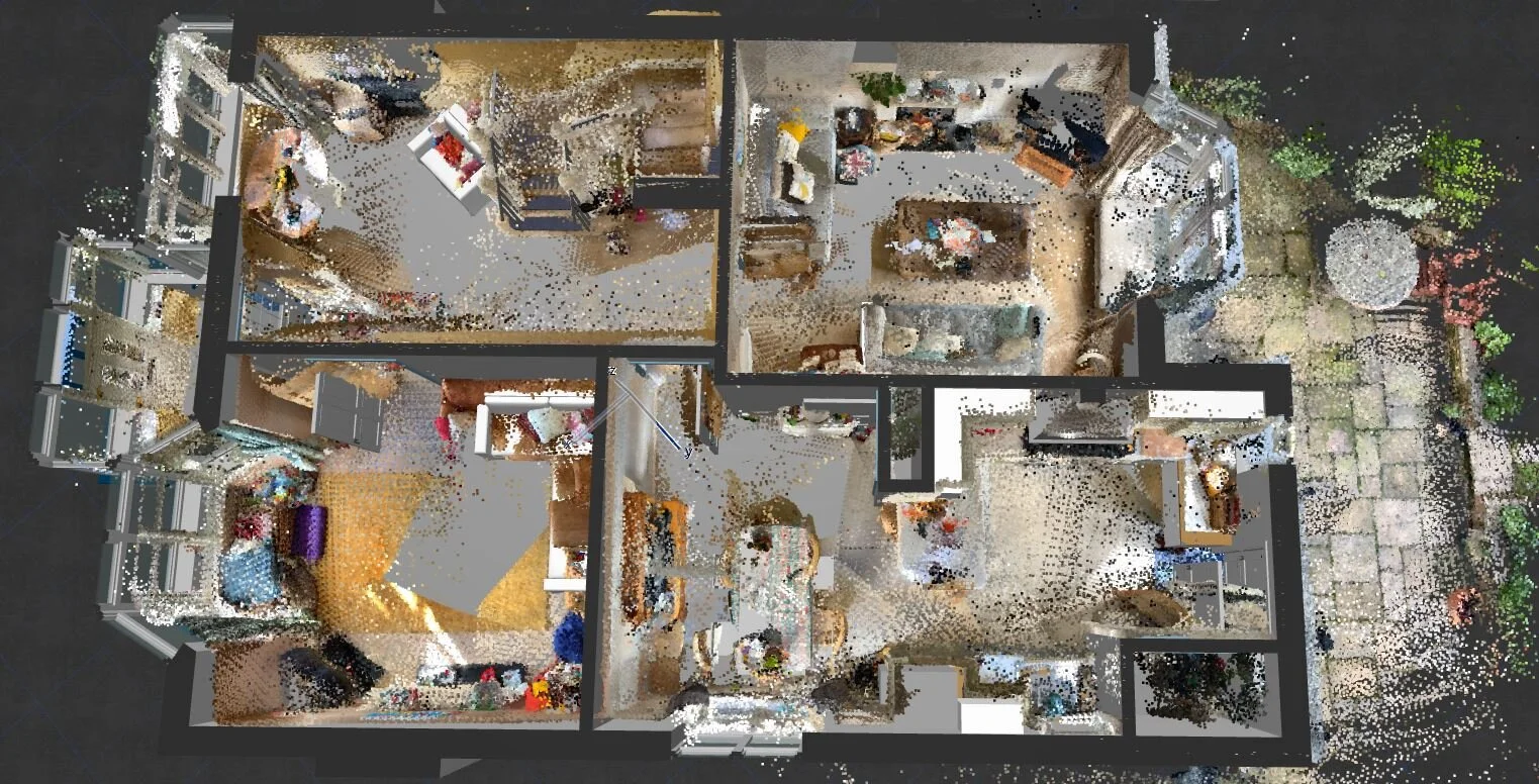
One such SiteScaper is Rob Nabney at Nabney Plans, an architecture firm based in Christchurch, England. His team works mainly on adaptations to existing homes, conversions from agricultural to residential and backland development -- and is using SiteScape to scan existing site conditions to bring into their BIM environments, creating digital models of their architectural sites to share as a visual reference for their clients.
Rob told us, “We have been using Sitescape Beta on our iPad Pro for some months now and have found it to be a really useful tool to help us create the as-built architectural model. By scanning one or two rooms at a time and then bringing each point cloud into ArchiCAD individually rather than as one big cloud enabled us to mitigate current scan limits. SiteScape’s been perfect for small-to-medium-scale residential projects.”
Using scans in ArchiCAD as a reference for the building model
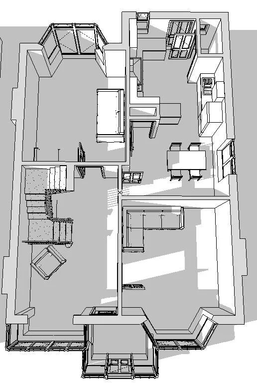
Final Building Model
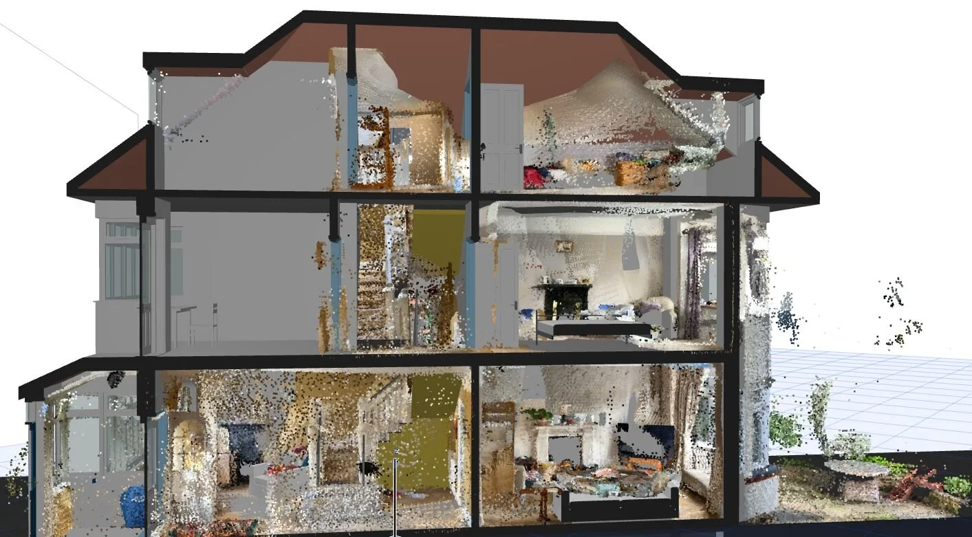
View of the entire project
We look forward to working with SiteScapers around the world over the coming months to understand how you’re using our tools, and how we can support you as we continue to build.