Three Ways 3D Mobile LiDAR Scanning Technology is Transforming Design Workflows for Architects
Discover how industry-leading architects use cutting-edge site documenting and construction progress management tools to revolutionize workflows for increased accuracy and efficiency.
Creating drawings and designs for your project with manually obtained site measurements might seem like a tried, tested, and trusted method from the deep-rooted school of thought. However, relying on error-prone processes makes your work susceptible to major miscalculations, affecting your delivery standards and overall reputation.
Then some architects decide on a hybrid system, storing data, drawings, measurements, and designs across digital and physical repositories. This approach effectively ends the possibility of initiating any collaborative effort or a common source of truth between stakeholders and team members.
If you resonate with the pains of an inefficient workflow, breathe easy and know that it is possible, and not difficult, to elevate your performance out of mediocracy using tools already available in the market. Among the trailblazers boosting the performance of architects are 3D site scanning apps that run on smart devices equipped with powerful LiDAR scanners.
Discover how these innovative tools on the market are helping architects like yourself propel their efficiency on projects.
Incorporating 3D Mobile LiDAR Scanning into your workflow
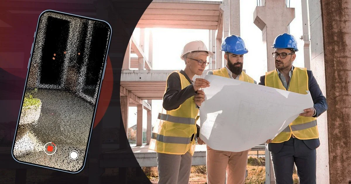
Using apps and software that leverage technological advancements like 3D LiDAR scanners enables your team to perform quick inch- and scale-accurate 3D site scans anytime. This method translates to more precise and accurate site drawings and designs that reference actual scans of an area. The convenience of having such scanners within your everyday gadgets, like the iPhone 12, 13, 14, 15 Pro, or latest iPad models allows for planned or ad-hoc scans that produce high-quality and fully immersive 3D imagery in just minutes. These cutting-edge tools help promote better visualization by other team members while ensuring your captured 3D scans are saved, sorted, and backed up onto a single source of truth accessible by all stakeholders and team members.
Using a single source of truth to boost collaboration and alignment within your team
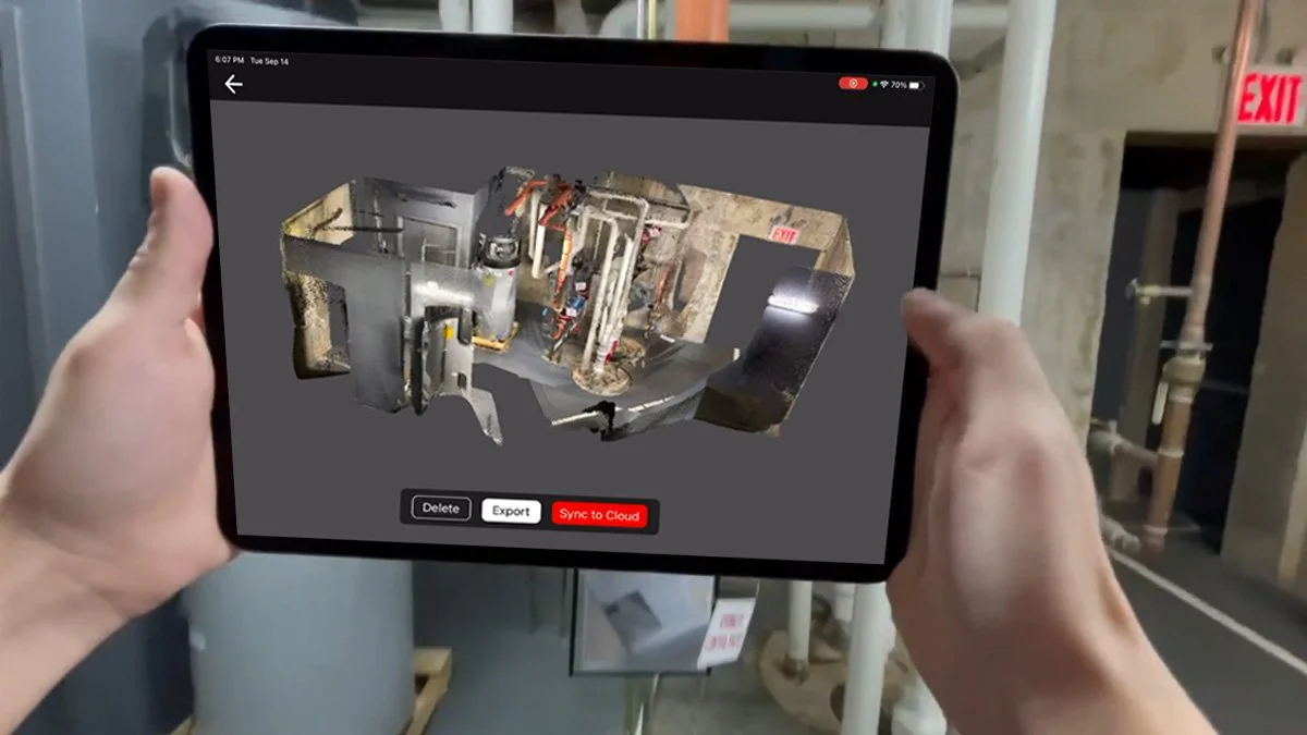
Digital 3D scanning or construction progress management tools allow you to store and merge your 3D scans and relevant information into a standard point cloud model. This results in a version that is shareable and accessible by everyone working on the project. Other functions like GCs, MEPs, or project owners can reference this model and provide input during the pivotal design stages, eliminating errors and mistakes.
The interoperability of these digital tools provides you and your stakeholders with accurate 3D recreations of the site that are readable and compatible with conventional BIM workflows, including RCP, E57, PLY files, and CAD models. Having all these critical and sensitive data in a single source of truth simplifies storing, managing, and retrieving the most up-to-date information. Digital repositories also save time spent on data entry and management by keeping a historical and chronological record of your visualizations, reports, and issues as and when information is uploaded.
Leverage the power of digital construction workflows to drive efficiency and unlock new savings
Incorporating digital site documenting tools into your workflow enables immersive virtual walkthroughs of your site using rich 3D models that reduce the need for time-consuming, costly, and potentially dangerous on-site visits by other stakeholders. Providing stakeholders with an efficient and context-rich workflow solution that meets project requirements, without inflating timelines or budgets, helps nurture rapport while elevating your reputation. High-delivery standards increase your marketability and chances of securing future jobs.
Discover SiteScape’s World of Efficient Mobile 3D Site Scanning
SiteScape is an advanced site documenting tool that leverages the LiDAR scanners built into your iOS devices, iPhone 12, 13, 14, 15 Pro, or the newest iPad models, to produce inch- and scale-accurate 3D scans, saving you hours in field measurements and thousands more in reworks.
Combine several scans into one and unlock new levels of efficiency by saving hours on drafting and modeling. Export your 3D scans as industry-standard RCP, E57, or PLY files integrable into your existing BIM or CAD workflows.